Observing Siberian wildfires with Forestry TEP
It is not unusual to have wildfires in Siberia in the dry months of the summer. But this year, hot and dry weather combined with strong winds have fuelled fires to such an extent that a state of emergency has been declared in many parts of Siberia. Already millions of hectares have burnt, destroying forests and producing high carbon emissions. Large parts of Siberia, including big towns, have been blanketed with thick haze originating from the wild fires.
Satellite sensors provide excellent means for wildfire monitoring. Sensors with thermal bands (like the VIIRS sensor) detect active fire locations covering the entire globe daily. High resolution optical sensors, like the Multispectral Imager (MSI) on board Sentinel-2 satellite, provide detailed images of the affected areas in visible to shortwave infrared wavelengths. With the less than 5-day revisit time of Sentinel-2 satellites in Siberia, these data provide powerful means for monitoring the progress and effects of the wildfires.
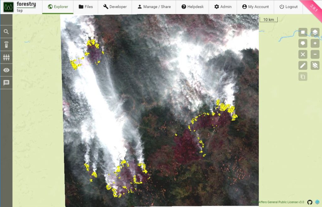
The pictures above and below show examples of a Sentinel-2 image acquired in the Krasnojarsk Krai area on the 6th of August 2019. The data has been manipulated using image processing tools available in Forestry TEP. In the feature (real colour) image above the smoke billowing from the fires and the overall hazy air conditions are clearly visible. VIIRS active fire detections are overlaid on the image (in yellow dots), pointing out the locations of active fire fronts.
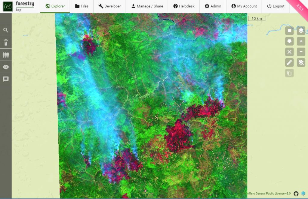
The picture below is a false colour impression of the same Sentinel-2 image. Red, green and blue colours have been replaced with short wave infrared (2.1 µm), near infrared and red wavelengths, respectively. This wavelength combination provides a better view of the effects of the fires. With the smoke less visible in the longer wavelengths and the burn scars (dark red) clearly outstanding against the vegetated areas (variations of green colour), the magnitude of the fires becomes evident. Note that the image is 110 km × 110 km in size, revealing the huge extent of the burn scars. The largest burn scar to the right of the image is already over 40 km long. And still burning.